
FCRT works with local governments to prioritize, promote, and complete trail improvement, maintenance, and repair projects.

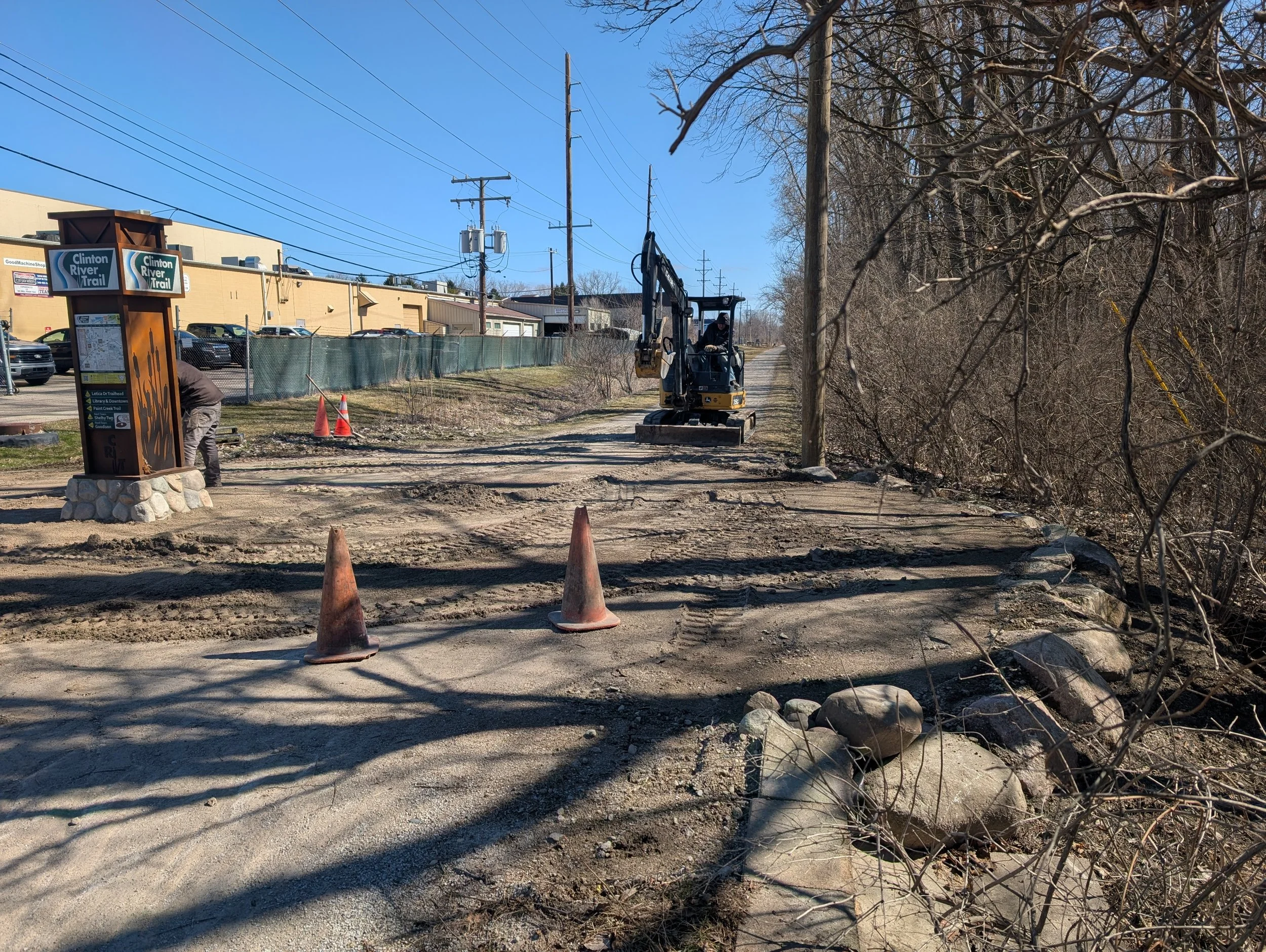
Rochester Washout 1 Repairs
Updated May 18, 2026
Location: https://maps.app.goo.gl/Vvm8u16jTJfcrxhd9
Estimated Completion: Fall 2026
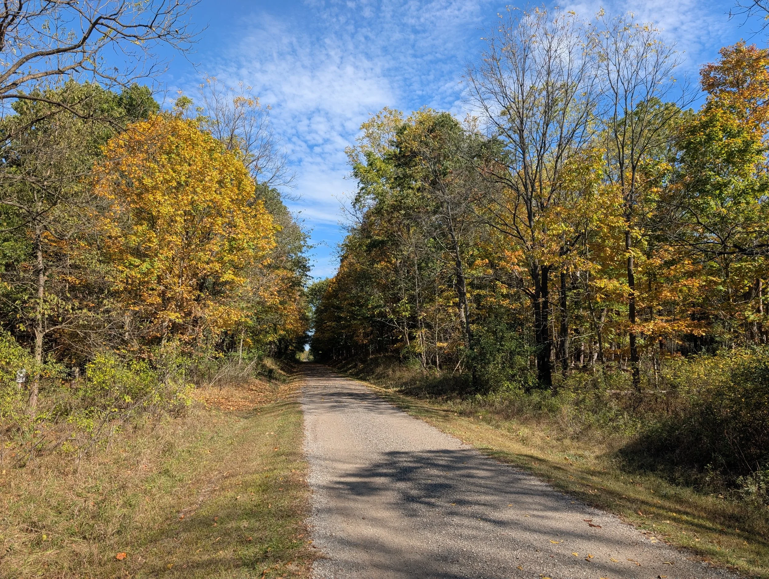
In July 2024, after a series of heavy rain storms, a 150’ section of the CRT in Rochester washed away. Many months of fundraising, surveying, designing, engineering and contracting are finally bringing much needed repair to fuition.
The Clinton River Trail and Macomb Orchard Trail are closed between the Letica Trailhead and 24 Mile Road in the City of Rochester & Shelby Township through spring 2026. Please follow the detour route and check back for updates.
The City of Rochester, Oakland County, Friends of the Clinton River Trail, and several other entities and contractors are working on repairs. Get the latest updates from the City of Rochester here, or text “CRTProject” to 38276 to subscribe to text alerts. The Macomb Orchard Trail closure is intermittent and related to the GLWA 96” Water Main project.
FCRT hosted the Washout Info Session on September 10th, 2025. View the slides. Rochester City Council received a presentation on the repair progress on July 14th, 2025. Watch the video, view the slides, or read the press release.
Rochester Washout 2 Repairs
Updated May 19, 2026
Location: https://maps.app.goo.gl/togz1po2t93dHd2x6
Estimated Completion: Summer 2026
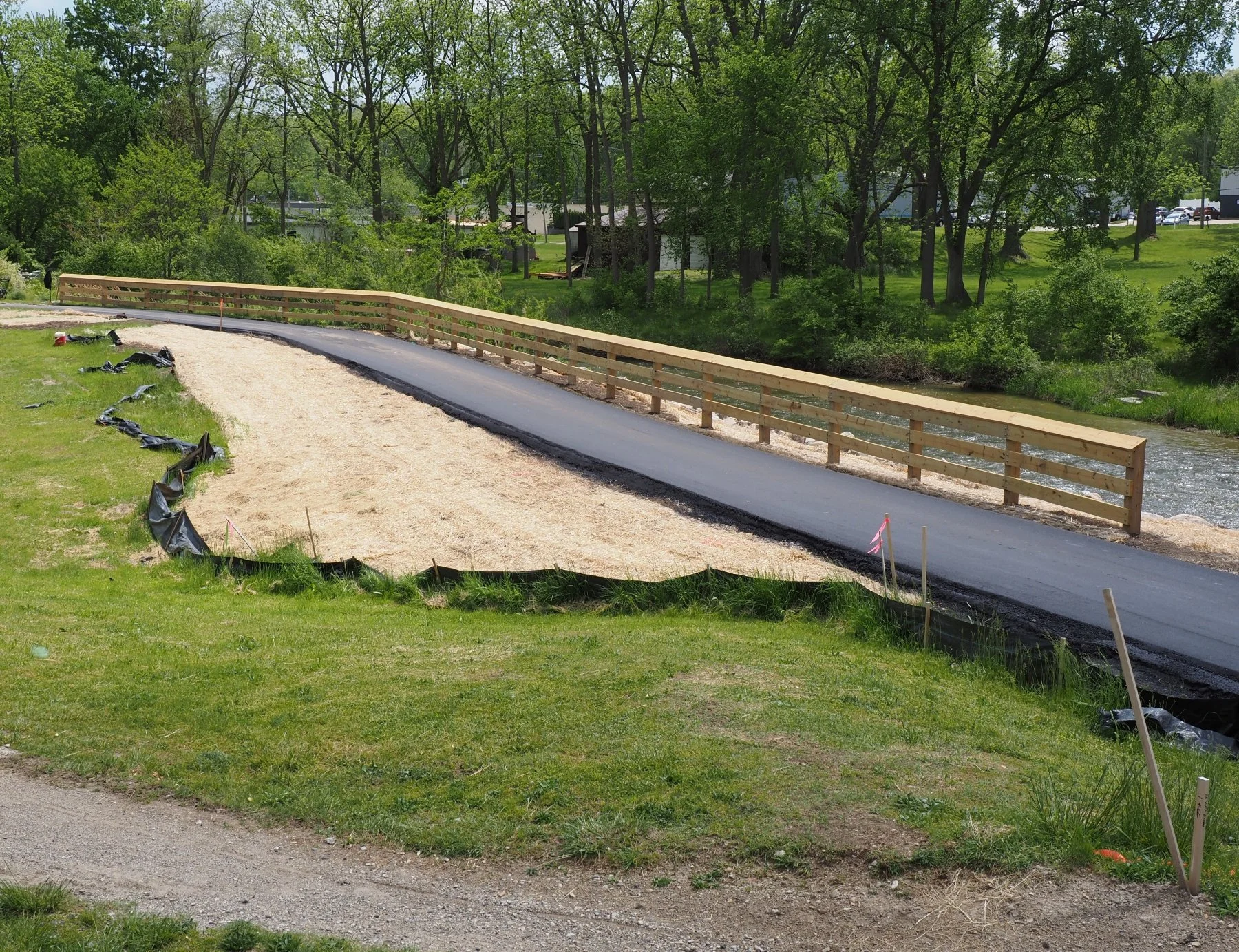
The Clinton River began to undercut a retaining wall supporting the trail near Diversion St in Rochester. Eventually, the wall collapsed. The river bank is now being fortified and the grade decreased, and the trail is being pushed back several feet to avoid this issue in the future. This project is very near completion. Workers are performing final restoration activities. Please respect closures to support the last steps of this project.
North Spur
Updated May 19, 2026
Location: Opdyke Rd to Michigan Ave - Map
Estimated Completion: End of 2026
The North Spur is a new portion of the Clinton River Trail in Pontiac with a HAWK connecting the Opdyke trailhead with residential Michigan Ave. This project is part of the long-term plan to complete the trail in Pontiac.
Once open, the North Spur will terminate on the west side at Michigan Ave in Pontiac. Upon completion of the Pontiac Pike Street Connector, the North Spur will be part of a complete trail in Pontiac, connecting the trail from Opdyke Rd to Bagley St. Until then, it is a spur (out and back) trail. Some, especially experienced cyclists, may find riding on Pike St as is preferable to the official trail route along South Blvd.
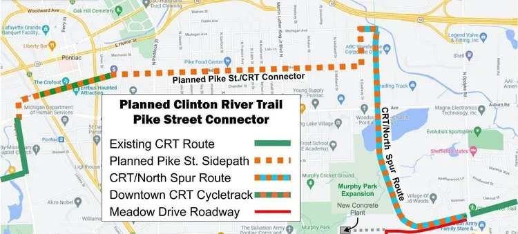
Pontiac Pike Street Connector
Updated May 19, 2026
Location: North Spur to Bagley St via Downtown Pontiac
Estimated Construction Timeframe: 2027/2028
This project is the final phase of connecting the CRT within Pontiac via downtown. See the dotted orange line on the map. The City has been awarded a grant to complete the project. It will include road reconstruction, addition of a cycle track, and side path improvements. It will run from the west end of the North Spur (map) to Bagley St.
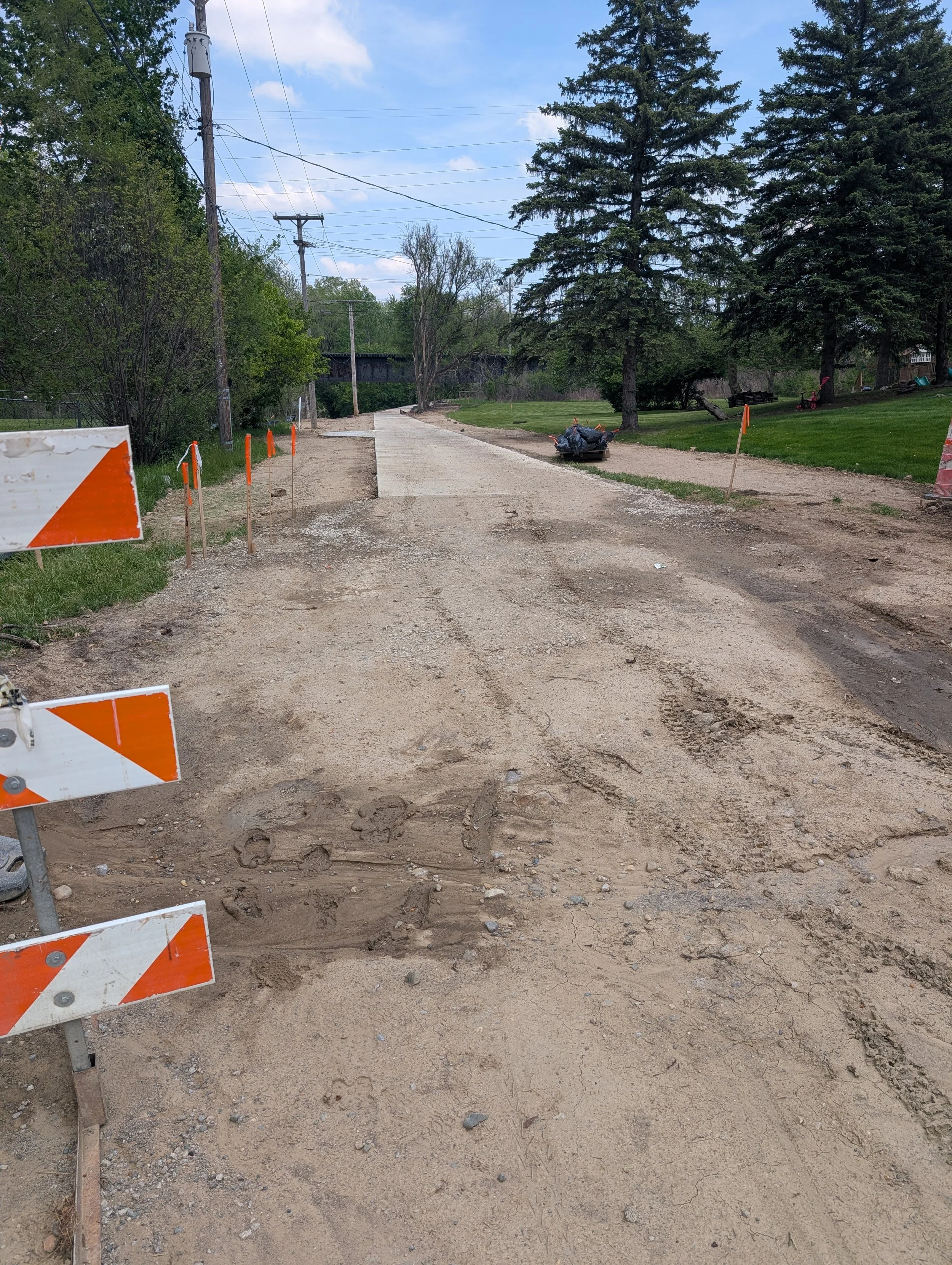
Rochester Rest Area
Updated March 27, 2026
Location: https://maps.app.goo.gl/NyGk66aorwvbViBAA
Estimated Completion: Spring 2026
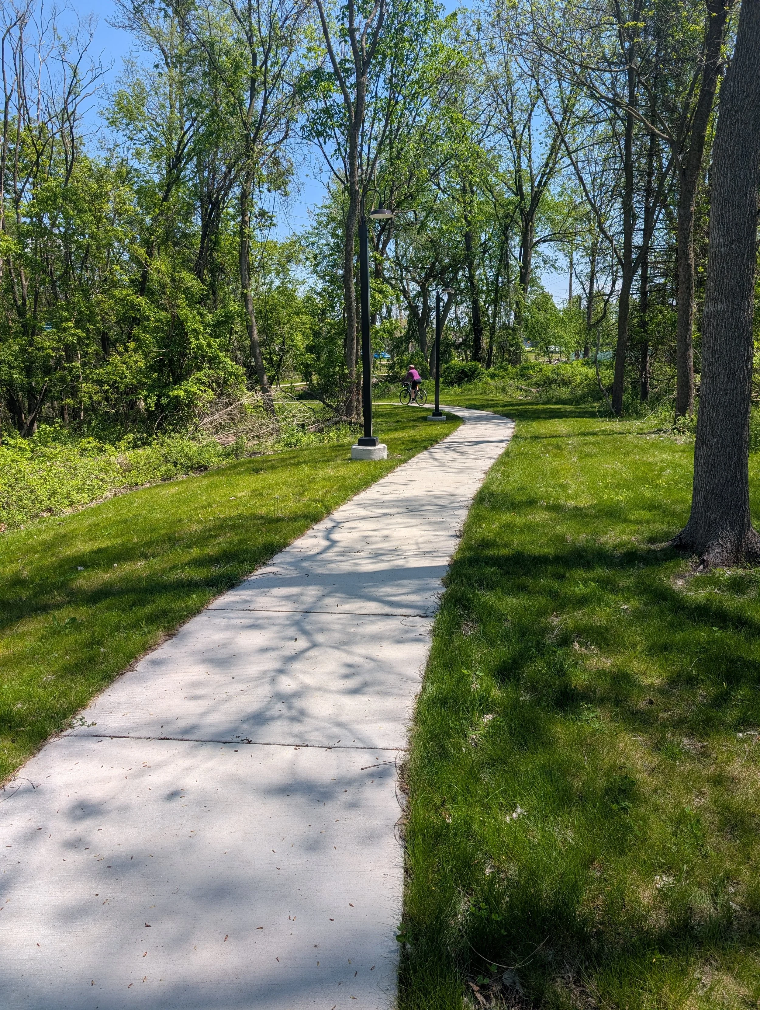
Workers are constructing a new rest area in Rochester where the trail connects with the Rochester River Walk (leading to the Paint Creek Trail). This new respite site along the Clinton River will feature benches, a waste bin, and historic brick pavers from Rochester’s Main Street surrounding the trail intersection kiosk. Funds for this project were generously donated in memory of Patrick J. Kennedy with the assistance of Michigan Trails and Greenways Alliance.
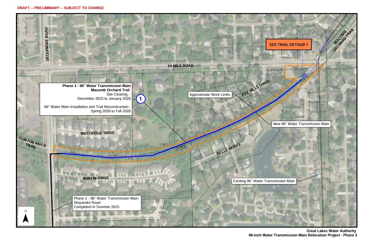
GLWA Water Main
Updated March 25, 2026
Location: Macomb Orchard Trail Between Dequindre Rd and 24 Mile Rd
Estimated Completion: Fall 2026
While not technically part of the Clinton River Trail, this project impacts the trail network. The Macomb Orchard Trail (MOT) immediately east of the Clinton River Trail’s terminus at Dequindre Rd will be closed intermittently during the project. We recommend this detour route to avoid both the CRT Washout and MOT closures.
More information from GLWA: https://www.glwater.org/96inchwatermain/
Completed Projects
Adams Rd Mid-Block Crossing
Project Completed Spring 2025
Location: https://maps.app.goo.gl/6wFyeAPyqoWNv68B6
A new HAWK and side paths connect the trail near the Leach Road trailhead with the transit, restaurants, retailers, and services at Adams Marketplace on Marketplace Circle.
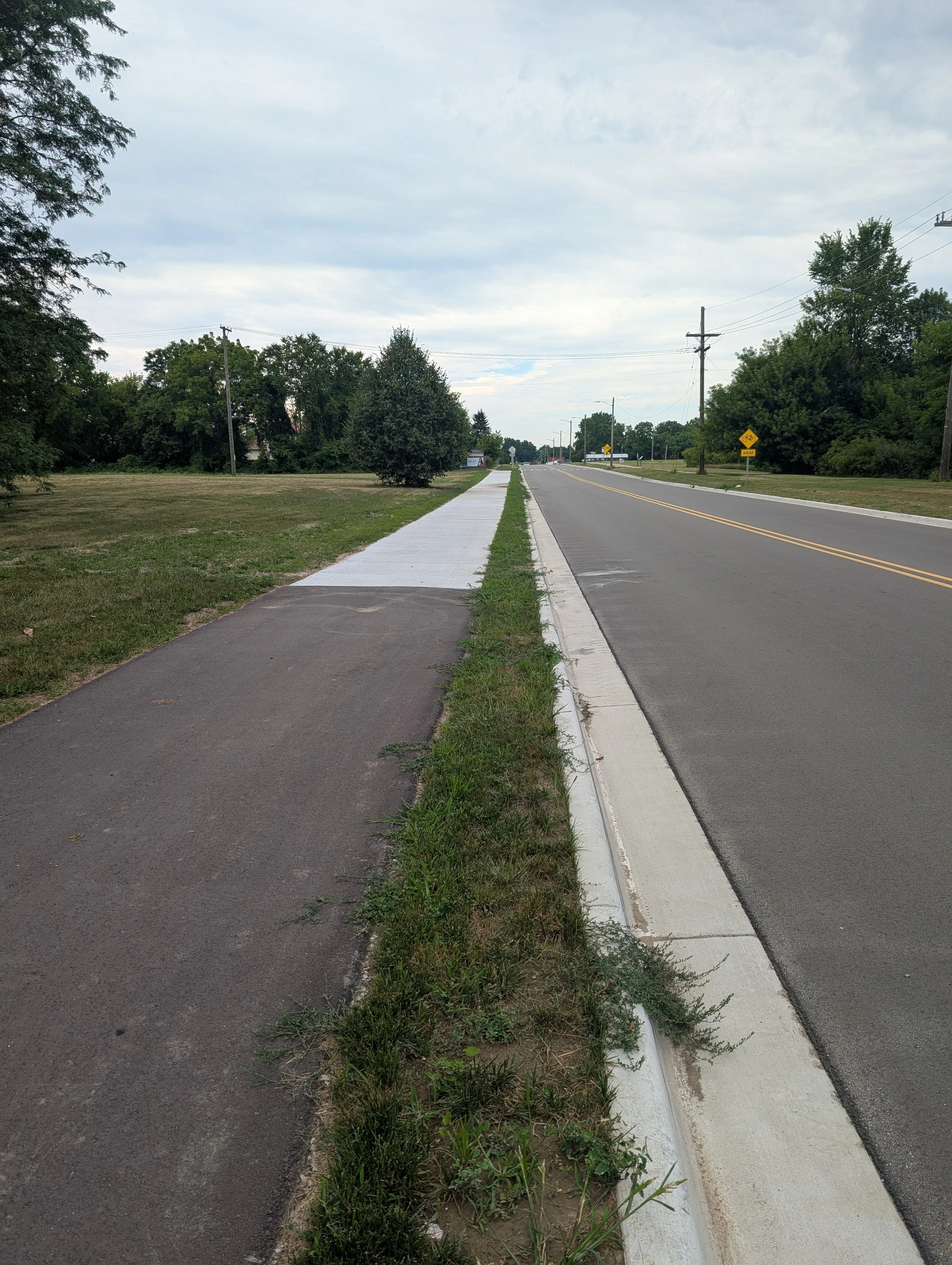
Bagley St Side Path
Project Completed Summer 2025
Location: https://maps.app.goo.gl/2xD9cWXma4LbQTkH7
A new 8 foot wide side path (also know as a safety path) was added to the west side of Bagley St, vastly improving the temporary route in Pontiac. The new path spans from the Clinton River Trail south to Golf Dr/South Blvd. Compared to the sidewalk on the east side of Bagley, this new side path is wider, smoother, and has far fewer road and driveway crossings. Once the proposed permanent trail is complete within downtown Pontiac, this new side path will continue to enhance the Clinton River Trail’s network and connectivity.
Telegraph Rd Side Path Connector
Project Completed Fall 2024
Location: https://maps.app.goo.gl/6VM5SqTEVYwXPnPU7
A new paved path connects the Clinton River Trail just west of the Telegraph Rd bridge to the side path along the west side of Telegraph Rd. It expands the trail’s network by providing a connection to all the businesses, services, and housing accessible from Telegraph Rd. The path doesn’t yet appear on Google Maps, but you can see it on our interactive map, Apple Maps Satellite View, or OpenStreetMap.
CRT Pontiac Improvement Project
Project Completed Spring 2023
Location: Pontiac from Bagley St to Pontiac Dr
This is the largest project FCRT has ever undertaken at a cost of $750,000. While other projects cost more, they were financed and managed by local governments. This project included resurfacing 1.75 miles of trail, road crossing improvements including the HAWK at Beaudette Park, bridge railing replacements, and consistent signage.